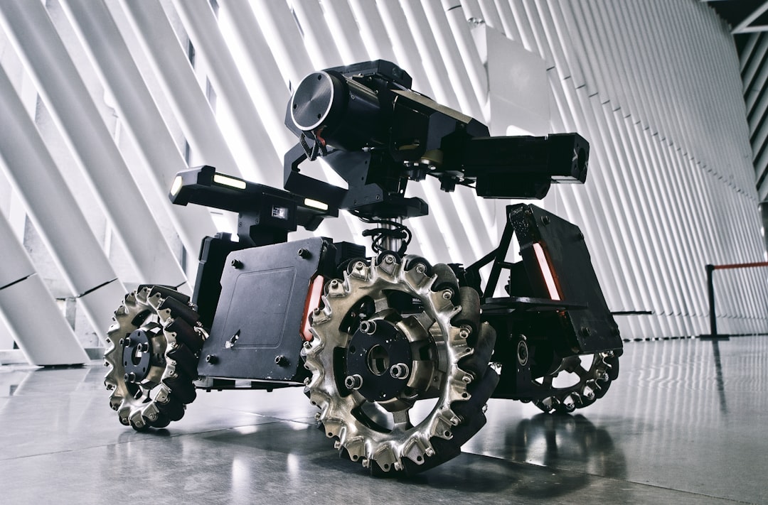
Autonomous systems increasingly operate in places where satellite navigation is unreliable, degraded, or completely unavailable. Indoor warehouses, underground mines, dense urban canyons, forests, tunnels, battlefields, underwater environments, and extraterrestrial terrain all challenge traditional GPS-based positioning. In these settings, real-time navigation depends on algorithms that can estimate position, map surroundings, avoid obstacles, and make decisions using onboard sensors and computation.
TLDR: The best real-time navigation algorithms for GPS-denied autonomous systems combine sensor fusion, SLAM, visual or LiDAR odometry, and local path planning. No single algorithm is ideal for every environment; the strongest systems usually blend multiple methods to balance accuracy, robustness, and speed. Modern approaches increasingly use learning-based perception alongside classical filtering and optimization to improve navigation in complex, uncertain conditions.
Why GPS-Denied Navigation Is Difficult
GPS-denied navigation is challenging because an autonomous system must estimate its own motion without relying on an external global reference. Instead of receiving coordinates from satellites, the system must infer its location from sensor measurements such as cameras, inertial measurement units, LiDAR, radar, sonar, wheel encoders, barometers, magnetometers, or ultra-wideband beacons.
The difficulty increases when environments are dynamic, poorly lit, visually repetitive, dusty, smoky, reflective, or featureless. A drone flying through a warehouse may struggle with motion blur and narrow aisles. An underwater robot may rely on sonar because cameras are limited by turbidity. A ground robot in a tunnel may lose visual features and face wheel slip. In all cases, the navigation algorithm must operate in real time, meaning it must make fast estimates while the vehicle is moving.
1. Sensor Fusion with Kalman Filtering
One of the most widely used foundations for GPS-denied navigation is sensor fusion, especially through variants of the Kalman filter. These algorithms combine measurements from multiple sensors to produce a more reliable estimate than any single sensor could provide.
The Extended Kalman Filter, or EKF, is commonly used when systems involve nonlinear motion and measurement models. It is popular in drones, ground vehicles, and mobile robots because it can fuse inertial data with visual odometry, wheel odometry, magnetometer readings, barometric altitude, or range measurements.
The Unscented Kalman Filter, or UKF, can handle nonlinearities more accurately than the EKF in some cases, though often at a higher computational cost. Both filters are valuable because they are efficient enough for embedded processors and can provide continuous state estimates, including position, velocity, orientation, and sensor biases.
Best use cases:
- Small drones using IMU, barometer, and optical flow sensors
- Ground robots combining wheel encoders, IMU, and visual odometry
- Autonomous vehicles needing stable short-term pose estimation
- Robots with limited onboard computing resources
Kalman filtering is not always enough on its own. It can drift over time if no external correction is available. For that reason, it is often paired with SLAM, odometry, or map-matching algorithms.
2. Simultaneous Localization and Mapping
Simultaneous Localization and Mapping, better known as SLAM, is one of the most important algorithm families for GPS-denied autonomy. SLAM allows a robot to build a map of an unknown environment while simultaneously estimating its position within that map.
SLAM is especially powerful because it addresses two core problems at once: Where is the robot? and What does the world around it look like? The algorithm uses sensor data to identify landmarks, surfaces, or geometric structures, then updates both the robot pose and the map as new observations arrive.
Several SLAM variants are commonly used:
- Visual SLAM: Uses camera images to track features and estimate motion.
- LiDAR SLAM: Uses laser scans or point clouds to build accurate geometric maps.
- Visual Inertial SLAM: Combines cameras with IMU data for improved robustness.
- Graph Based SLAM: Represents poses and constraints as a graph, then optimizes the graph for consistency.
- Semantic SLAM: Adds object-level understanding, such as recognizing doors, walls, people, or vehicles.
SLAM is highly effective in structured indoor environments, urban spaces, caves, warehouses, and industrial facilities. However, it can be computationally demanding. Real-time SLAM systems must balance mapping detail with processing speed, especially on lightweight robots with limited power.
3. Visual Odometry and Visual Inertial Odometry
Visual odometry estimates movement by analyzing changes between sequential camera frames. It tracks visual features, compares their motion across images, and calculates how the camera has moved through the environment. This technique is useful for drones, mobile robots, augmented reality devices, and planetary rovers.
Visual odometry can be implemented with monocular cameras, stereo cameras, or RGB-D cameras. Stereo and depth cameras provide scale information more directly, while monocular systems usually require additional information to recover accurate scale.
Visual inertial odometry, or VIO, improves visual odometry by combining camera data with IMU measurements. The IMU captures rapid acceleration and rotational motion, while the camera corrects long-term drift. This pairing is especially valuable for aerial robots because drones move quickly and may experience rapid rotations.
VIO is often considered one of the best real-time options for small GPS-denied autonomous systems because cameras and IMUs are lightweight, low power, and relatively inexpensive. Algorithms such as feature-based VIO, direct VIO, and tightly coupled optimization frameworks are widely used in robotics and autonomous flight.
4. LiDAR Odometry and Mapping
LiDAR odometry estimates movement by matching laser scans or point clouds over time. Because LiDAR measures geometry directly, it can perform well in low-light environments where cameras struggle. LiDAR-based navigation is common in autonomous cars, warehouse robots, mining vehicles, and inspection robots.
LiDAR odometry algorithms typically compare current point clouds against previous scans or a local map. They use geometric features such as planes, edges, and surfaces to estimate motion. When combined with mapping, the system can generate detailed 2D or 3D representations of the environment.
LiDAR is particularly strong in structured environments with stable geometry. However, it may struggle in heavy rain, fog, smoke, dust, or environments with too few distinct surfaces. High-resolution 3D LiDAR sensors can also be expensive and power hungry. For smaller platforms, solid-state LiDAR or 2D LiDAR may offer a better balance.
Advantages of LiDAR navigation include:
- Accurate distance measurements
- Strong performance in darkness
- Reliable geometric mapping
- Good compatibility with occupancy grids and obstacle avoidance
5. Particle Filters and Monte Carlo Localization
Particle filters are probabilistic algorithms that represent a robot’s possible states using many samples, known as particles. Each particle represents a possible location and orientation. As the robot moves and collects sensor measurements, unlikely particles are removed while more likely particles are reinforced.
Monte Carlo Localization is a well-known particle filter method used when a map is already available. It is valued because it can represent uncertainty in complex, non-Gaussian ways. This makes it useful when the robot might be uncertain about its starting location or when sensor data is ambiguous.
Particle filters can be robust and flexible, but they may require a large number of particles for high-dimensional state spaces. This can increase computational load. For real-time systems, engineers often optimize the particle count, use adaptive sampling, or combine particle filters with other estimation methods.
6. Occupancy Grid Mapping and Local Planning
Navigation is not only about localization. A GPS-denied autonomous system must also avoid obstacles and choose safe paths. Occupancy grid mapping divides the environment into cells and estimates whether each cell is free, occupied, or unknown. This map can be built from LiDAR, sonar, depth cameras, radar, or stereo vision.
Once a local map exists, path planning algorithms select a route through it. Common real-time planners include:
- A Star: A graph search algorithm that finds efficient paths using a heuristic.
- D Star and D Star Lite: Useful for replanning when the environment changes.
- Rapidly Exploring Random Trees: Helpful in high-dimensional or complex spaces.
- Model Predictive Control: Optimizes control actions over a short future horizon.
- Dynamic Window Approach: Selects safe robot velocities while considering motion constraints.
For real-time autonomy, local planning is usually paired with global strategy. In GPS-denied environments, the global reference may be a previously built map, a topological map, a mission route, or a relative waypoint system rather than satellite coordinates.
7. Radar and Sonar Based Navigation
Radar and sonar algorithms are essential when optical and LiDAR sensors are unreliable. Radar navigation can perform well in dust, rain, fog, smoke, and poor lighting. It is increasingly used in autonomous driving, industrial vehicles, defense robotics, and all-weather drones.
Sonar navigation is critical for underwater autonomous systems, where GPS signals do not penetrate and cameras may be limited. Sonar-based SLAM and acoustic localization can help underwater vehicles map seafloors, inspect infrastructure, and navigate pipelines or submerged caves.
Radar and sonar data can be noisy and lower resolution than camera or LiDAR data, so algorithms must handle uncertainty carefully. Probabilistic filters, scan matching, and learned perception models are often used to extract reliable navigation information.

8. Learning Based Navigation Algorithms
Machine learning is becoming more influential in GPS-denied navigation. Deep neural networks can improve perception, detect obstacles, estimate depth, identify semantic landmarks, and predict traversable terrain. Reinforcement learning can train agents to navigate complex spaces, though safety and generalization remain important concerns.
Learning-based approaches are most effective when combined with classical algorithms. For example, a neural network may identify doors, corridors, vehicles, or people, while a SLAM system performs geometric localization. A learned depth model may assist visual odometry, while a Kalman filter maintains stable state estimation.
The strongest real-time systems often use hybrid architectures. Classical algorithms provide interpretability, stability, and mathematical guarantees, while learning models provide adaptability and richer environmental understanding.
How to Choose the Best Algorithm
The best navigation algorithm depends on the platform, environment, sensors, computing limits, and mission requirements. A small indoor drone may favor visual inertial odometry because it is lightweight and fast. A warehouse robot may use LiDAR SLAM with occupancy grid planning. An underwater vehicle may depend on sonar SLAM and inertial navigation. A military ground robot may combine radar, LiDAR, IMU, cameras, and robust sensor fusion.
Key selection criteria include:
- Environment: Indoor, outdoor, underwater, underground, aerial, or urban.
- Lighting: Cameras require usable visual conditions, while LiDAR and radar are less light dependent.
- Compute budget: Real-time SLAM and deep learning may require GPUs or dedicated accelerators.
- Accuracy needs: Inspection and manipulation tasks may require centimeter-level precision.
- Robustness: Mission-critical systems need redundancy and fault tolerance.
- Cost and power: Sensor choice strongly affects platform size, endurance, and budget.
Most Effective Real-Time Navigation Stack
For many GPS-denied autonomous systems, the most reliable solution is not a single algorithm but a layered navigation stack. A strong stack may include IMU-based prediction, visual or LiDAR odometry, SLAM-based map correction, Kalman filter sensor fusion, occupancy grid mapping, and real-time local planning.
This layered design reduces dependence on one sensor or method. If cameras fail in darkness, LiDAR or radar may continue operating. If wheel odometry drifts due to slip, inertial and scan-matching data can correct it. If a map becomes outdated, local obstacle avoidance can still protect the system.
Ultimately, the best real-time navigation algorithms are those that maintain accurate localization, safe motion, and fast decision-making under uncertainty. GPS-denied autonomy requires resilience, not just precision. The most successful systems combine complementary algorithms into a robust architecture designed for the target mission.
FAQ
What is GPS-denied navigation?
GPS-denied navigation refers to autonomous movement in environments where satellite positioning is unavailable, unreliable, jammed, blocked, or too inaccurate for safe operation.
What is the best algorithm for GPS-denied autonomous systems?
There is no universal best algorithm. In many cases, the strongest approach combines SLAM, sensor fusion, visual or LiDAR odometry, and real-time path planning.
Is SLAM necessary for GPS-denied navigation?
SLAM is not always necessary, but it is often highly valuable. Systems that operate in unknown or changing environments commonly use SLAM to build maps and localize within them.
Which is better for GPS-denied navigation: LiDAR or cameras?
LiDAR is often better for accurate geometric mapping and low-light conditions, while cameras are lighter, cheaper, and provide rich visual information. Many systems combine both for improved robustness.
Can autonomous drones fly indoors without GPS?
Yes. Indoor drones commonly use visual inertial odometry, optical flow, LiDAR, ultrasonic sensors, or SLAM to estimate position and avoid obstacles without GPS.
How does sensor fusion improve navigation?
Sensor fusion combines data from multiple sensors to reduce uncertainty and compensate for individual sensor weaknesses. For example, an IMU provides fast motion estimates, while cameras or LiDAR correct drift over time.
Are AI-based navigation algorithms replacing classical methods?
AI-based methods are improving perception and decision-making, but they are usually combined with classical algorithms rather than replacing them entirely. Hybrid systems tend to be more reliable for real-time autonomy.
What sensors are most useful in GPS-denied environments?
Common sensors include IMUs, cameras, LiDAR, radar, sonar, wheel encoders, barometers, magnetometers, and depth cameras. The best sensor set depends on the operating environment and mission requirements.